
How do pro-Palestinian materials show land ownership before
and after the establishment of the state of Israel? With biased maps like this.

Wow! Looks like the
Jews took so much land away from Palestinian owners. What the first map does not explain is that it
includes public lands as Palestinian, even though those areas were owned
by the Ottoman Empire for centuries and then controlled by the British Mandate
after World War One!
What the third map of the four does not
explain was that by the end of the war in 1948, Gaza was under Egyptian Rule
and the West Bank was ruled by Jordan.
These dictatorships the ruled those same public lands, yet the maps
still mark those lands as Palestinian.
Just like in any area of the USA, land was split between public and private ownership before the State of Israel was established. Here’s a map that addresses that mix of public and private ownership in 1945.

So what land was actually owned by Jewish or Arab individuals or organizations? Glad you asked. When we take out public lands from the claims of Palestinian ownership, the maps look like this:
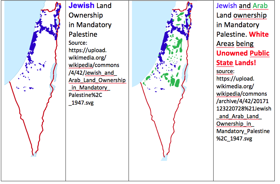
In fact, the UN partition plan, accepted by the Yishuv (pre-state Government) looks as wacky as it does because it tried to follow those patterns of ownership.

While this
plan was far from perfect, and asked for serious concessions from Arabs and
Jews, it was a practical effort to create two states based on the land owned by
two different groups of people. When the
Armistice of 1949 was drawn, that potential Palestinian state was now split
between Jordan, Egypt and Israel.
No comments:
Post a Comment